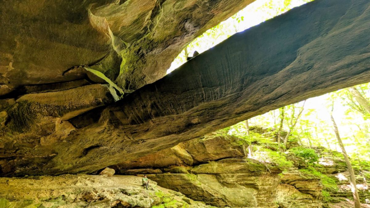
Yellow Birch Ravine: A Hidden Indiana Hiking Gem
Yellow Birch Ravine Nature Preserve: Indiana’s Other Turkey Run
As an Amazon Associate, I earn from qualifying purchases. This post may contain affiliate links, which means I earn a small commission if you buy through them at no extra cost to you.
View any list of Indiana’s top hiking destinations, and Turkey Run State Park will be at the top, and rightfully so; the park is full of beautiful hiking trails.
But if you want something with just as much beauty and fewer crowds, I suggest checking out Yellow Birch Ravine within Hoosier National Forest.
Located roughly two and a half hours south of Indianapolis and an hour northwest of Louisville, the three short trails found in this hiking area are excellent for a bit of healthy forest bathing.
Although the trail has a Taswell address, the nearest town with amenities, such as restaurants, is English.
Google Maps will take you right to the parking lot, but don’t blink, as it is pretty small, with room for only 3 small vehicles, or two big ones.
We arrived on a Sunday around 11 am and found only one other car parked, but by the time we left the area 2 and a half hours later, the parking lot was full, and several people were parked down the side of the street.
The road isn’t a busy one, and there are no signs up saying you can’t park on the side of the road –at least not yet.
Yellow Birch Nature Preserve has three trails and two trailheads. I will start with the one on the same side of the road as the parking lot.
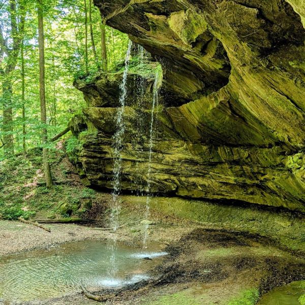
The Trail to Double Falls
If you use the AllTrails app, this trail is currently listed as “Yellow Ravine Trail,” and the trail I named “East Ravine Trail” is listed as “Double Waterfall Trail.”
However, we were there in early May after significant rainfall, and as you will see in my photos, what I am calling Double Falls clearly has two waterfalls side by side. When I did a bit of online research, I found other photos like mine labeled Double Falls.
So I am sticking to my labeling, since there are no trail signs anywhere on the trails.
This trail is a little less than a mile out and back. If you go in early Spring or late Fall after a rain, the waterfall at the end should be running. But if it is dry, you will still get to enjoy an amazing rock shelter.
FYI – If you go after a rainfall, the trail may be a bit muddy and the rocks a bit slick; don’t be like me and wear your Birkenstocks. Instead, I suggest trail runners and maybe even hiking poles if you struggle with balance.
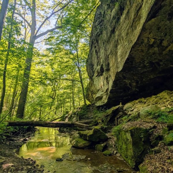
Take all the little side trails
Several small paths off the main trail lead to the creek that runs through the preserve; be sure to explore them, as you will discover miniature waterfalls in the small streams and beautiful rock formations, like honeycomb.
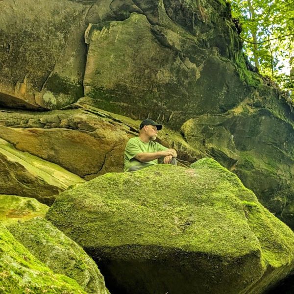
Make sure to take the fork in the trail that heads right
Roughly one-third of the way up the trail, you will see a small trail to your right. Take it!
At the end are beautiful, moss-covered rocks and a seasonal waterfall called Bowl Falls (at least I think it is; as I said, different people seem to call these waterfalls different names).
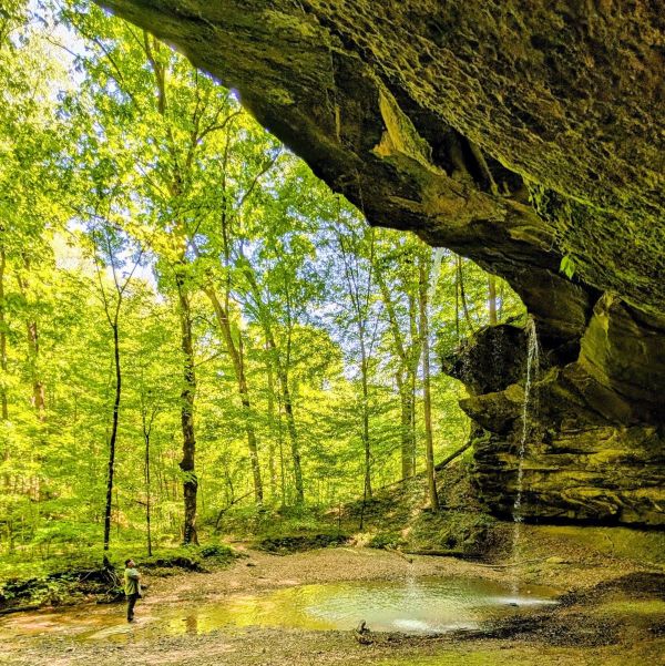
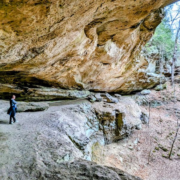
At the end of the trail, you will see a large rock shelter, and if you visit after a good rainfall or two, you should see two waterfalls falling into a beautiful pool of water
The trail will go further than this, but as far as we could tell, and we hiked it until the end, there isn’t anything beyond the rock shelter. But oh what a rock shelter.
Jack and I both agreed that it reminded us of a Whispering Cave in Hocking Hills State Park, Ohio. It is a lot smaller, but just as pretty!
Trail To Ravine Arch
After working your way back to the parking lot, make sure to cross the street. There you will find the entrance to a trail that splits a short way up; go left, and you are on the trail toward Ravine Arch.
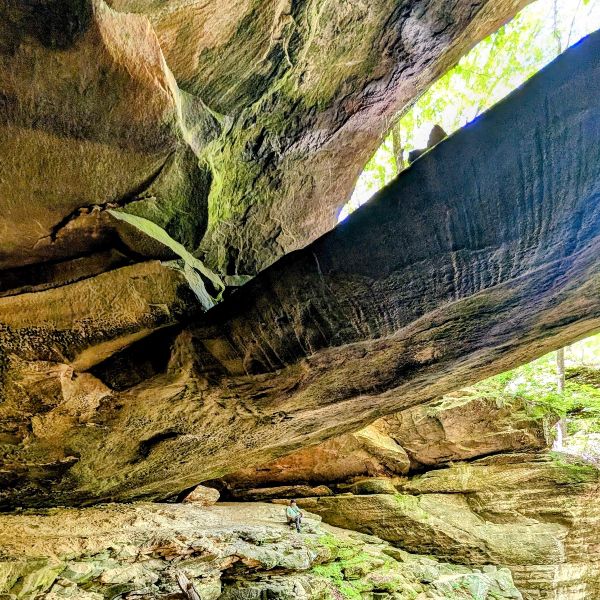
The path you follow is 1.1 miles round trip. It is relatively flat and easy terrain until the very end of the trail, where you will need to do a bit of rock scrambling to get the best view of the arch.
Ravine Arch is one of two known sandstone arches on public lands in Indiana, the other being Portland Arch. It is an impressive 22 feet across and stands 16 feet off the ground at its highest point.
A Warning About Natural Caves In The Preserve
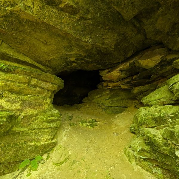
If you take the spur trail off to the side along the way to or from the arch, you will find an entrance to a small cave. Please note that Wild caves like this one on Indiana public land are protected to save local bat populations from White-nose Syndrome, and the unmarked cave interiors can contain dangerous, unmapped drops. You can look at the entrance but don’t go in.
Trail to Eastern Ravine Falls
Remember how I told you that the trail on this side of the road splits in two early on. If you take the trail to the right, you will reach Eastern Ravine Falls.
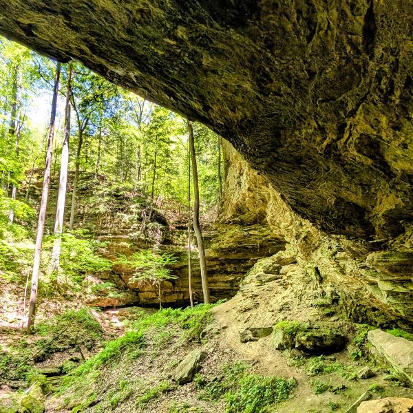
This waterfall was pretty small when we went, and that was during peak waterfall season for Indiana, but the Ravine itself is so beautiful I don’t think you will be disappointed having hiked to the end of the trail only to realize there was no waterfall, as you will be too busy staring in awe at the steep rocky cliffs.
The path to the ravine follows the stream; keep your eye out for this mostly covered-in-moss RED ROCK.
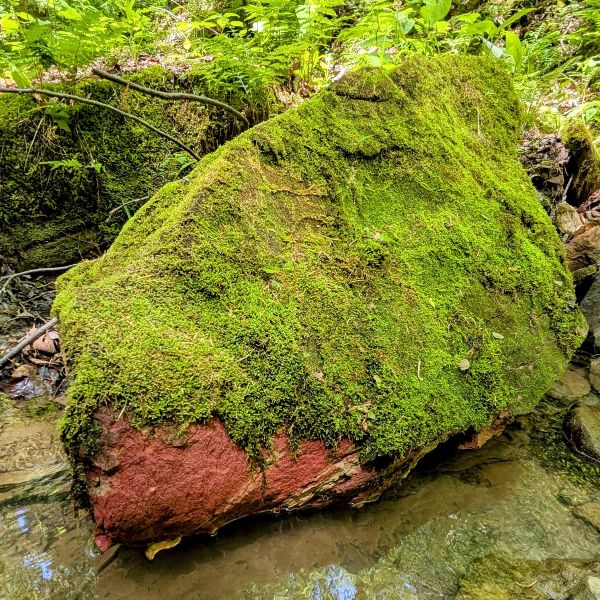
Now, if you are not a long-time resident of Indiana, or if you really have not explored our state, you might not think that a red rock is anything special, but Jack and I have lived here for over 25 years and done quite a bit of hiking in the Hoosier state, and we both stopped to take several pictures of this crimson rock because that is how rare it is here.
I am not a geologist, but based on my limited study of why a large, red rock is found in an area where most rocks are tan or gray, it is either an iron ore deposit found only in a few areas of Southern Indiana or a glacial erratic.
Either way, it is worth finding along the trail and marveling at.
If you find yourself making your way back to your vehicle with a bit more time and energy to hike another trail, I have listed a few more within thirty minutes of Yellow Birch Ravine Nature Preserve.
Additional Hiking Nearby
Sycamore Springs
15-minute drive
This free park is run by a non-profit. It has 4 short hiking trails, with the High Bridge trail, featuring its spiral staircase and waterfall, being the most popular in the park.
The park also has a campground, numerous playgrounds and picnic shelters, and a fishing pond. (Open April 1 to November 1 only)
Hemlock Cliffs
15-minute drive
Hemlock Cliffs is also in Hoosier National Forest. You’ll find a much larger parking lot and a 1.2-mile loop trail that takes you through a stunning sandstone box canyon. The canyon has seasonal waterfalls.
Jack and I hope that you enjoy Yellow Birch Ravine as much as we did. It’s a great hike, full of lush greenery and beautiful yellow birch and hemlock trees.
For more wonderful hikes in Indiana, check out this list – I update it a few times a year with new-to-us Indiana hidden gem hikes, so make sure to pin it to your Pinterest boards so that you can access it later.